
Clipper City Rail Trail & Harborwalk
May 18, 2023:
To date, four phases of the 3.3 mile Clipper City Rail Trail have been constructed during the past decade or so and the corridor is used and enjoyed by thousands of people. The full continuous rail trail loop around the core of Newburyport is almost complete, and the remaining sections to be built include MassDOT’s crossing of Route 1 at the rotary and developer Ed Hill’s trail section along Parker Street.
MassDOT initiated a $17M project in the spring of 2023 to resurface Route 1, and the project includes reconstructing the rotary in Newburyport and installing a multiuse pathway missing link along with pedestrian-activated signals for crossing the highway. There are links to MassDOT’s conceptual plan and pavement markings plan available on this page. The overall 7-mile project in Newbury, Newburyport, and Salisbury including the rotary work will take approximately 2.5 years to complete.
On Parker Street, developer Ed Hill is required by a 2017 Special Permit condition to construct the final 100-yard “missing link” section of the trail as part of his development of 23 new units of housing. In 2022, he constructed a piece of the trail adjacent to the cemetery entrance, and he is required to complete the rest of the trail prior to receiving a Certificate of Occupancy for his last housing unit. Currently, he has completed 17 units and is working on the remaining 6. The city is in regular contact with Mr. Hill, and he has not yet indicated exactly when he plans to construct this final trail section.
June 14, 2021:
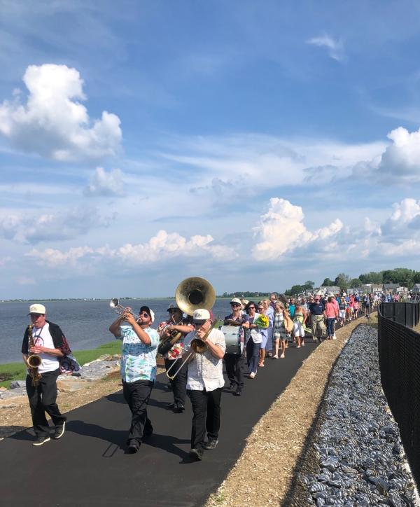
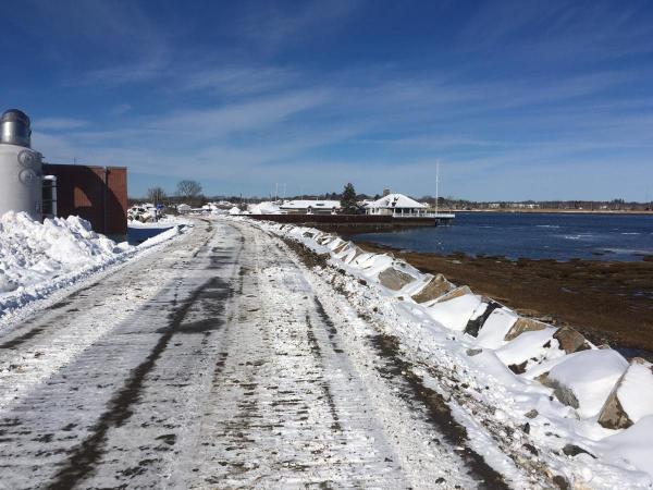
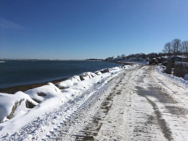
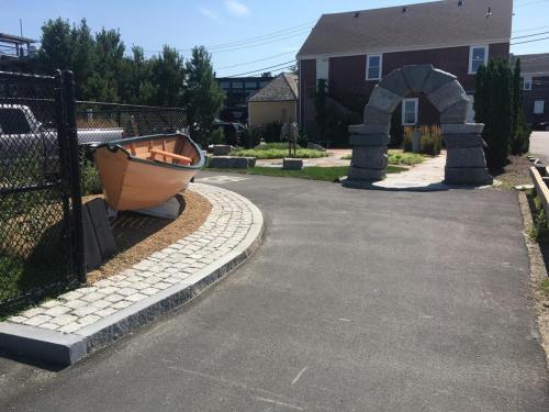
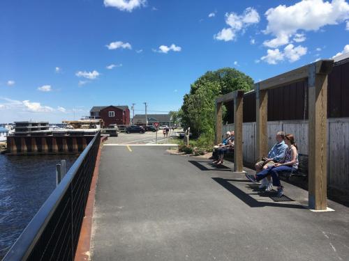
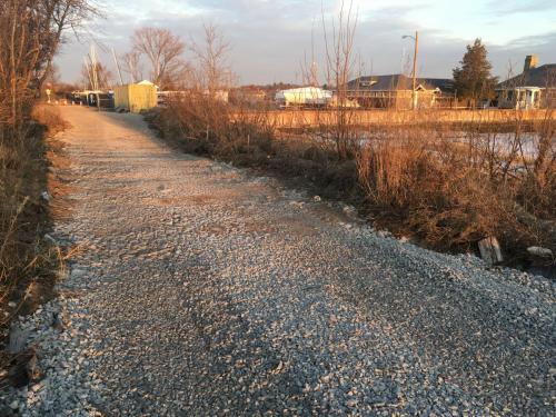
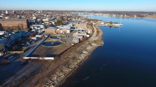
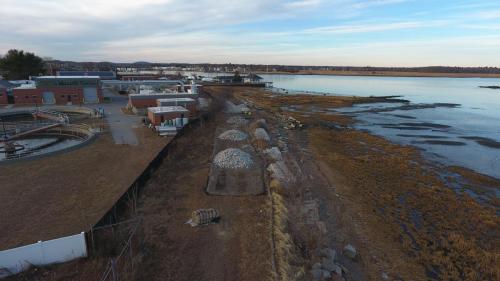
Construction of the Critical Infrastructure Protection and Clipper City Rail Trail project along the shoreline has been completed. The utility contractor installed new raised manholes for the underground electric duct bank, and the municipal contractor paved the trail and installed landscaping and amenities, including a shipwreck play sculpture. The corridor opened to the public in late May, and a well-attended ribbon cutting ceremony and a parade lead by the Hot Tamale Brass Band was held on June 9th, 2021.
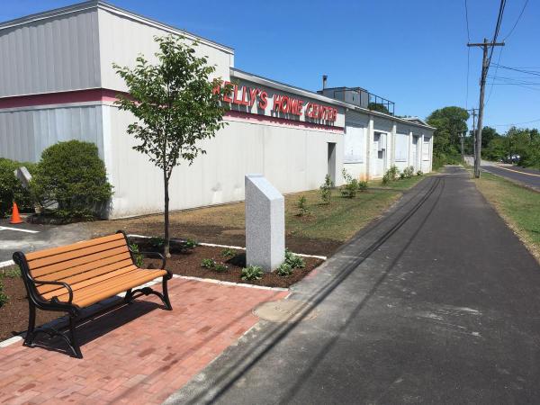
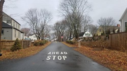
In regard to the Phase III project at the southern end of the Rail Trail loop on Parker Street, the City’s contractor installed the pedestrian-activated traffic signal to facilitate crossing State Street and paved a section of the trail corridor. A memorial garden for Pete Kelly has been installed at the State Street corner, courtesy of the Institution for Savings. The corridor is open to the public as the contractor waits for the supply of timber guardrail to install between the trail and the road and complete the project this summer.
February 11, 2021:
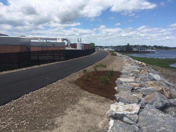
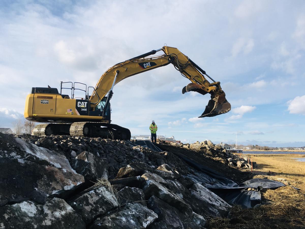
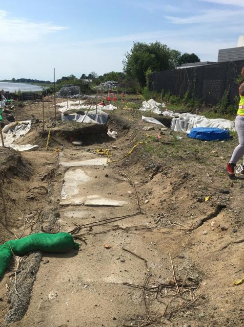
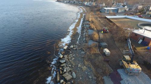
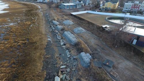
The City’s contractor George R. Cairns & Sons, Inc. has largely constructed the 900’ raised sloped stone revetment protecting the shoreline of the old rail corridor behind the Wastewater Treatment Facility, installed an adjacent section of vertical seawall, and is working to finish installation of the cap stones at the top. The contractor has brought in fill to raise the grade of the berm behind the revetment on which the trail will be constructed, and which will help protect the WWTF from storm surge and sea level rise. Next steps include work by National Grid’s contractor to modify the underground duct bank and manhole access to accommodate the new grade. In the spring, the new paved trail will be constructed on top, and the landscaping, planting, and amenities installed.
December 22, 2020:
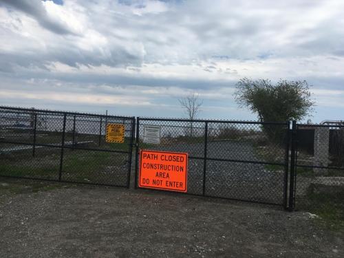
The City received a $1 million grant this fall from the Commonwealth’s FY21 Municipal Vulnerability Preparedness (MVP) Action Grant Program to support construction of the Critical Infrastructure Protection and Clipper City Rail Trail project along the shoreline behind the Wastewater Treatment Facility (WWTF). The sloped stone revetment and berm installed by this project will help protect the WWTF from storm surge and sea level rise. The waters of the Merrimack River and the Atlantic are expected to rise approximately two feet during the next fifty years due to climate change, and this project will help prevent flooding of the WWTF which would cause severe consequences. The project will help protect the underground electric transmission lines that power Newburyport, and install a section of the paved and universally accessible Clipper City Rail Trail on top of the berm. The City was also awarded a $100,000 grant from the Commonwealth’s MassTrails Grant program to support construction of the project, in addition to $150,000 in CPA funding and other match funding approved by the City Council. The City subsequently bid the project out, hired a contractor George R. Cairns & Sons, Inc., and construction began on the revetment/berm/trail project in December. The work is anticipated to take about six months and be completed by the summer of 2021. Public access to the 1200-foot shoreline corridor will be restricted during the six-month construction timeframe for safety purposes, and trail users will need to use the interim detour along Water Street until the project is finished.
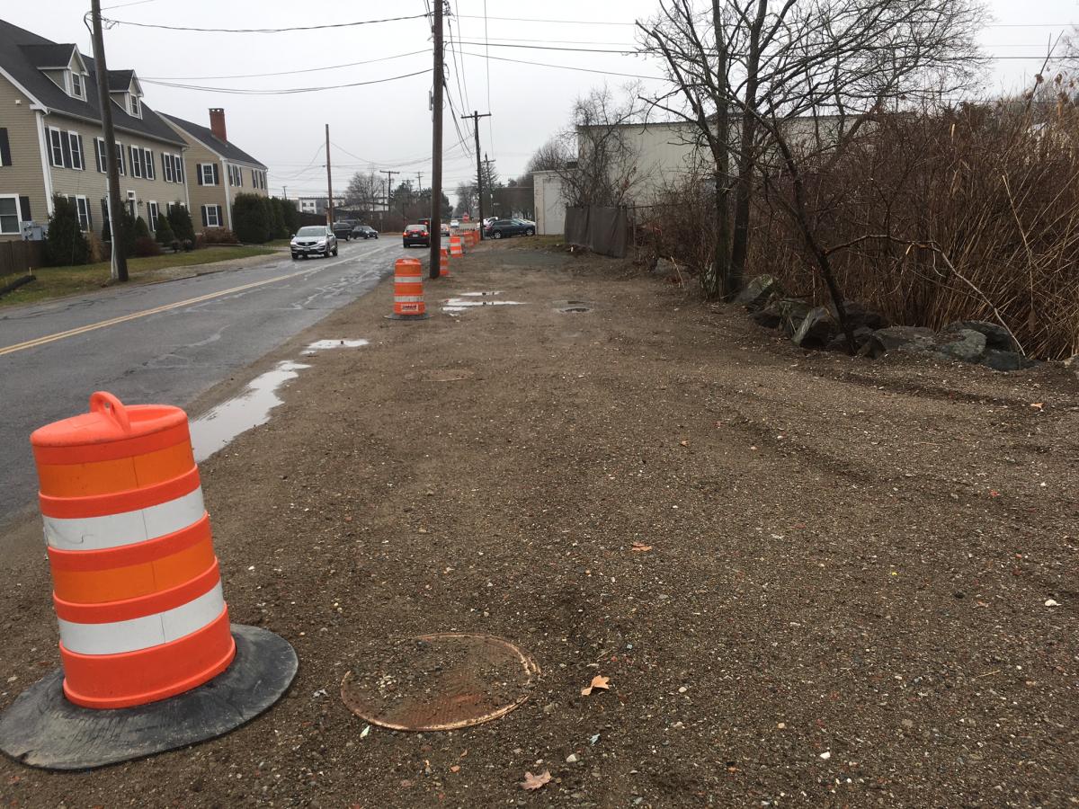
In addition, the City received a $400,000 grant from the Commonwealth’s Complete Streets Program to support construction of a section of the Parker Street Trail connection, along with matching funding from the Community Preservation Committee and City Council. The Parker Street Trail project will begin to close the gap between Phase I and Phase II of the popular Clipper City Rail Trail, and will significantly improve public safety in this area. There are currently no accommodations for pedestrians and bicyclists in this area. The project has bumped out the curbing at the State Street/Parker Street intersection to shorten the crossing distance for pedestrians and bicyclists and improved the drainage. The project will install a defined crosswalk and a pedestrian-activated HAWK traffic signal (the acronym stands for High-intensity Activated crossWalK). The project will also construct a 400-foot-long 10-foot-wide paved pathway adjacent to Parker Street. The City bid the project out, hired a contractor Aqua Line Utility, Inc., and began construction in the fall. The contractor will return to finish the project in the spring of 2021.
August 12, 2020:
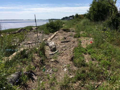
In a recent conference call, the DEP and EPA recently approved the City’s plan to backfill the excavated area in the stretch of old rail corridor along the shoreline behind the Wastewater Treatment Facility – this is a long-awaited and important milestone. Based on this approval, we hope to be able to open the old shoreline rail corridor to informal public access in mid-September based on the necessary next steps outlined below.
The required cleanup, and then the subsequent backfill plan, have been complicated and delayed by the presence of some remaining contaminated soil adjacent to the buried 23,000-volt underground electric cables. We have had and continue to answer multiple queries from the DEP and EPA, e.g., providing further documentation of the cleanup target, further information from National Grid that the underground electric lines never contained PCBs, recalculating the risk characterization for public access, additional delineation sampling and analysis to further define the disposal area, etc. DEP and EPA have now accepted that the City’s contractor has excavated the safely accessible areas and achieved the cleanup goal in the old rail corridor and addressed the areas adjacent to the underground electrical utilities to the extent feasible. The regulatory agencies have also accepted our plan to install a geotextile fabric demarcating the original soil and then cover the remediation area with at least two feet of clean fill, bringing the grade back up at least 6” higher than original in that area. The deeper excavated trench areas around the direct buried electric cables and concrete duct bank will be covered by four to five feet of clean fill. This will allow us to then open the gates and allow the public to safely access the area informally until the anticipated construction phase of the raised revetment, berm, and paved Rail Trail. The City’s LSP has sent another report to the DEP and EPA with an updated Risk Characterization, documenting that there is no risk to the public accessing the corridor once the backfill is complete. We hope to get DEP’s review and approval of that report and risk characterization in the near term.
The City’s contractor, NRC/US Ecology, has sent samples of the crushed stone to be used as backfill, as well as the stone dust on top, for a full suite waste characterization analysis by a laboratory to document that it is clean fill, as specified. We will eventually need to provide formal documentation to the DEP that the new material being installed is clean fill. The results of the lab analysis are expected by around 8/17/20. Assuming the material is indeed certified as clean fill, and DEP has approved the updated risk characterization, the contractor will secure sufficient quantities of the backfill material and mobilize a large excavator machine to the site around the beginning of the week of 8/24/20. (The material is likely to be clean, but if the proposed backfill materials turn out to contain contaminants, the schedule would have to be pushed back by approximately two weeks while other backfill material is identified and tested.) The contractor has indicated that the geotextile, backfill and compaction should take approximately a week or so to implement, weather conditions etc. permitting. The contractor will then remove the larger equipment and bring in a mini excavator to excavate the pocket of contaminated soil on the other side of the WWTF fence during the first week of September. A few panels of the existing chain-link fence fabric and potentially a couple of posts will have to be temporarily removed to facilitate this excavation. Temporary chain-link construction fencing will be installed on the river side of this fencing gap to secure the area from the public. In the best case scenario, if all goes well, we hope to then be able to open the gates at either end of the old riverfront rail corridor in mid-September to informal public access. Work focused on the other side of the fence will continue, including post-excavation sampling, laboratory analysis, review and hopefully confirmation of achieving cleanup goals, and then backfill of that area. (If additional contamination is found as part of the iterative remediation process, we will have to repeat the process of additional excavation, sampling, and analysis in this WWTF area.) The regulatory agencies are considering the backfill plan in the old rail corridor as a “temporary” solution. Our LSPs are required to do additional calculations of risk as well as a bit more sampling and analysis to more fully characterize the disposal site, then provide a Phase II Comprehensive Site Assessment report to DEP, then provide a Phase III Feasibility report documenting the lack of any feasible alternative other than a cap, and then a Phase IV Final Report. The pocket of contamination inside the WWTF, where there is no public access, is legally considered part of the same site, and the City will need to fully deal with that in order to close out the entire site.
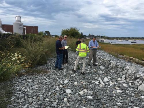
Regarding the subsequent revetment/berm/trail project, during the past few months we have significantly advanced the intensive permitting required – we have received a MEPA ENF Certificate from the EOEEA Secretary; we have received an Amended Order of Conditions from the Conservation Commission; we have submitted a DEP Waterways Chapter 91 License and Permit application; we have a submitted a federal Army Corps of Engineers Pre-Construction Notification Form (PCN); and drafted a CZM Consistency Review application. Permitting review and approvals will likely take the rest of the calendar year. The plans are well advanced, although some more work needs to be done. In terms of construction funding, we are pursuing a Plan A and a Plan B. Plan A is based on our submission of a $1.28 million grant request to the state Municipal Vulnerability Preparedness (MVP) program, which would require a match from sources such as local CPA funding, sewer enterprise fund bonding, and a $100K MassTrails grant. Plan B is federal and state transportation funding through the 5-year regional Transportation Improvement Program (TIP) of the Merrimack Valley Metropolitan Planning Organization (MVMPO), similar to the Phase I and Phase II Clipper City Rail Trail projects. The project is currently programmed as an FFY21 project on the TIP, and would require some additional match funding for MassDOT-supervised design and construction management. We hope to know by this fall which funding route is the most viable.
March 31, 2020 - Rail Trail Update:
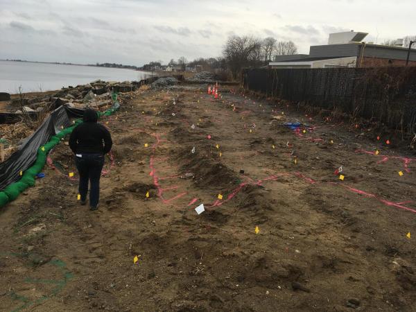
The cleanup of the PCB-contaminated soils in the fenced-off portion of the old rail corridor along the Merrimack River shoreline behind the Wastewater Treatment Facility is ongoing. PCB’s are (to some extent) similar to a virus, in that we cannot see, touch, hear, or taste them, but they are there and a threat to public health and we must take certain measures to address them. Previously, towards the end of last year, we had optimistically hoped that one round of excavation would be sufficient to allow for the corridor to be safely opened up for informal public use. Unfortunately, post-excavation sampling and laboratory analysis identified remaining contaminated soil that required a second mobilization of the contractor to excavate a smaller area and dispose of the soil. The subsequent sampling and analysis after this second phase of work identified a couple of remaining pockets of contamination adjacent to the underground electric concrete duct bank and adjacent to the rip rap. The process is slow and iterative. We are approaching the point where it will not be feasible to conduct any more excavation adjacent to the underground electric lines. The City’s consultants are currently negotiating with DEP and EPA as to whether they will require us to continue trying to excavate in proximity to the duct bank, particularly given that the end result will be the same of backfilling with at least two feet of clean fill, imposing an Activity and Use Limitation, and then rebuilding the sloped stone revetment and elevated berm with an additional five feet of fill as part of the next construction project. The area will continue to be closed off to the public until we are able to resolve the situation. Please know that we are working on it every day.
In the meantime, the City is moving ahead with the planning and permitting for the Shoreline Resiliency: Protection of Critical Infrastructure and Clipper City Rail Trail project. We received an additional grant to support this work along with the PCB remediation from the state’s Municipal Vulnerability Preparedness (MVP) program of $71,160. The City’s consultants have developed 25% Design plans for the revetment and berm and trail, and we have submitted an Environmental Notification Form (ENF) to the state’s Massachusetts Environmental Policy Act (MEPA) office. We have also requested a request for an Amendment to the existing Order of Conditions (OOC) from the Newburyport Conservation Commission. Once these two processes have unfolded – hopefully in April – we will be in a position to submit a Chapter 91 License application to the state, which is anticipated to take 6-9 months for processing. There is also some additional federal and state permitting that we will pursue later this year. We hope to complete permitting and design by the end of 2020. We are seeking construction funding, and hope to build the project in 2021.
November 26, 2019 – Rail Trail Update:
September 16, 2019 – Rail Trail Update
The City has secured the construction funding necessary for the cleanup of the PCB contaminated soils in the gated-off section of the old rail corridor behind the Wastewater Treatment Facility. Development of the plans and specifications for the bid package and the anticipated construction administration has been supported by a $100,000 grant from the Merrimack Valley Planning Commission’s (MVPC) Brownfields Program which administers federal funding from the Environmental Protection Agency, and the City has just received an additional $100,000 grant from the MVPC to support the construction phase of the cleanup. The Coastal Trails Coalition has generously provided a grant of $10,000 to support the cleanup. The City’s Community Preservation Committee and City Council recently approved $250,000 in CPA funding, which includes an 11% state match, for the cleanup plus advancement of the riverfront rail trail. The City is advertising and bidding the cleanup project out to contractors this month. Bids will be due in October, and we hope to mobilize a selected contractor in November 2019. The corridor will remain fenced off to the public until the excavation, removal of contaminated soil, verification sampling and analysis, and backfilling is complete which is anticipated at the end of January 2020. Once the cleanup is done, the City should be able to open the gates on either end of the riverfront corridor to allow the public to informally use the old rail corridor while we work towards re-engineering, permitting, fundraising, and eventually construction of the final paved riverfront rail trail section. The City’s consultants have developed preliminary plans, profiles, and cross-sections for this section of riverfront rail trail and is beginning the permitting process which could take 6-9 months.
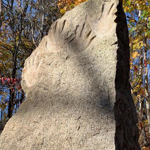
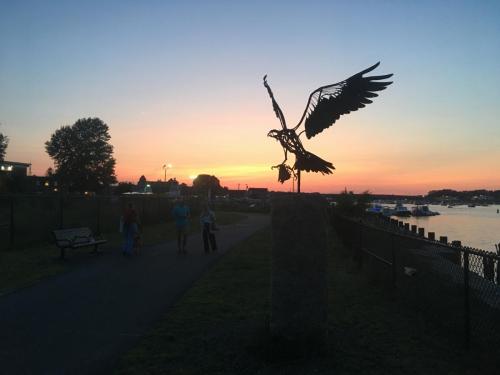
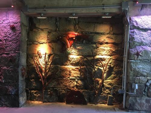
In addition, during recent months, the City has worked with various artists to install several new public sculptures along the Rail Trail, including the steel “Osprey” sculpture along the waterfront by Wendy Klemperer, the steel sea creatures installed in the High Street underpass called “Walk in the Deep” by Eric Harty, and “Dream” by Robert Motes on the trail off of Water Street.
The City has also been working on “Phase III” of addressing the complicated gap in the Rail Trail on the southern side near the commuter rail station. The City recently met with MassDOT District 4 who committed to a project that will install pedestrian and bicycle accommodations to safely cross Route 1 at the rotary. The state project will include the installation of handicapped accessible new pathways along the edge of the rotary around the former courtyard roast beef restaurant site and a new crosswalk with pedestrian-activated High Intensity Activated Crosswalk Beacon (HAWK) signals just to the north of the rotary. The project will be incorporated into the broader Route 1 project #608494 programmed for Fiscal Year 2021. These improvements will connect on the west with the 10’ walkway that was built by the City’s DPS along Parker Street and connects with Phase I of the Clipper City Rail Trail. On the east, the City is currently contracting with a consultant to design and build a 500’ section of off-road pathway along Parker Street including intersection and crosswalk improvements to the Parker Street-State Street intersection. This trail will connect with the 550’ section of pathway that is being designed and built by private developer Ed Hill/Parker 2 Realty Trust to the Newbury town line. A final step to be addressed later will be the last 300’ along Parker Street in Newbury to connect with the Clipper City Rail Trail Phase II trailhead.
May 8, 2019 – Phase II Rail Trail
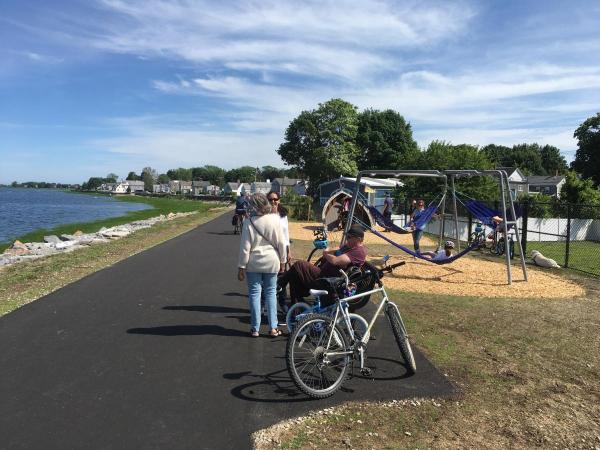
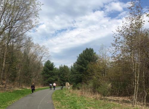
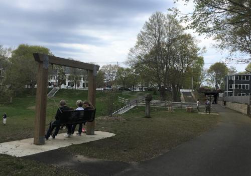
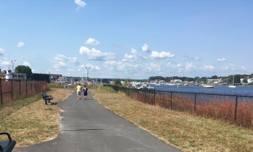
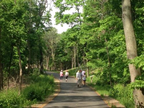
See images below of the public enjoying the Clipper City Rail Trail in the South End at the beginning of spring 2019.
May 2, 2019 – Phase II Project Update
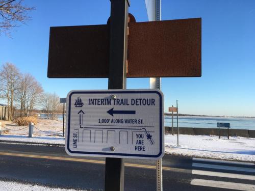
The fenced-off section of trail corridor along the Merrimack River behind the Wastewater Treatment Plant (WWTP) remains closed to avoid health risks until the City can clean up the contaminated soil. One of the final actions of the state contractor was to install interim detour signage (see photo below), plus some wheelchair ramp and crosswalk improvements, to temporarily route trail users along Water Street around the riverfront section of trail corridor. The public has enjoyed using the rest of the new Rail Trail during the winter and early spring, and the City has been working behind the scenes to address the “missing gap” shoreline portion of the Rail Trail. We have compiled and submitted three grant applications to support clean-up, re-design, permit amendments, and construction to the Newburyport Community Preservation Committee (CPC), the state MassTrails grant program, and the state’s Municipal Vulnerability Preparedness Grant Program. We should hear about funding decisions during the late spring and summer of 2019. The City’s Licensed Site Professional (LSP) consultant Stantec is developing a bid package of plans and specifications for the cleanup of the pcb’s, which will need to be reviewed and approved by National Grid, which owns property and underground electric lines in this vicinity. If some funding is secured from one or more of the grant programs, the City hopes to be in a position to bid the cleanup project out this summer of 2019. The remediation will include the excavation of the defined 130-foot area of soil, disposal, post-excavation verification sampling and analysis, backfill and compaction, and then the required reporting to MassDEP and EPA to document completion of the remedial activities during the fall of 2019. The re-design and local, state, and federal permitting for the riverfront section should take approximately a year.
The Planning Office has been coordinating with the Department of Public Services and others to integrate our approach to this shoreline corridor so that all the public infrastructure located here is protected as much as possible from climate change, storm surge, and sea level rise. The trail and the WWTP, which provides treatment for all the wastewater generated within the City and portions of Newbury, are located in a low-lying floodplain. The ground elevation of the rail corridor and the adjacent WWTP ranges from 8 feet to 13 feet; unfortunately, the Federal Emergency Management Agency (FEMA) has identified the base flood elevation (BFE) for a 1% annual flood hazard at 12 feet for the WWTP. The National Oceanographic and Atmospheric Administration (NOAA) predicts that sea level rise during the next 50 years will range from a low of 0.65 feet to an intermediate level of 1.64 feet. If this infrastructure is left unchanged and unprotected, erosion and inundation by intense storms and rising sea levels will undermine the trail corridor as well as the buried electric lines, shut down the treatment plant, cause sewage overflows into the streets, river, and ocean, produce major public health and environmental impacts, and require millions of dollars of lengthy repairs to the damage. The City has coordinated with three consultants, GZA, Stantec, and Dewberry, and developed a conceptual plan for the shoreline trail corridor which includes cleaning up the contaminated soil, and designing and amending permits for an elevated and reconstructed 14-foot revetment along the shoreline and a 14.5-foot berm with the Rail Trail on top. On a parallel track, the City will design 14’ concrete floodwalls to wrap inland around the eastern and western ends of the WWTP back to Water Street, which is at about elevation 14 feet, as well as design a pump station and diversion of stormwater around the WWTP. Completion of this initiative will protect the trail and the WWTP for many decades from storm surge and sea level rise, and will avoid a number of costs.
On another note, we have been working with several artists regarding the installation of some additional sculpture along the new Rail Trail this summer.
10/24/18 - Phase II Project Update:
The state contractor ET&L has substantially completed approximately 85% of the Phase II Rail Trail, including the section from the central waterfront to the American Yacht Club (AYC) and the section from Joppa Park to Parker Street in Newbury, with the exception of the stretch of riverfront in between Joppa Park and the AYC. The public has been using and enjoying the substantially completed portions of the trail for over a year. The state contractor has a few remaining landscaping and fencing obligations in the substantially completed areas, and then will finalize and turn over maintenance responsibility to the City’s Parks Department.
The fenced-off riverfront section between the AYC and Joppa Park will remain closed to the public, unfortunately, for at least a year due to significant unanticipated changes on the ground and consequent changes in the scope of work necessary for design, permitting, construction, and completion of this critical section of the trail. After additional soil sampling, a finalized soil remediation plan was filed with EPA and DEP for addressing the PCB contamination in a section of trail behind the Wastewater Treatment Facility (WWTF), but as the contractor began to mobilize in 2018 the riverfront was hit by significant storm surge and high tides which caused significant scouring of portions of the shoreline. It was determined that temporary shoreline stabilization needs to be implemented in the scoured areas prior to any remediation work or trail construction, and that a coastal engineer needs to develop a revised plan to raise the trail higher and harden/improve the resiliency of the shoreline to future sea level rise and storm surge. A temporary interim detour plan along Water Street has been developed, including signage and pavement markings and a revised wheelchair ramp and crosswalk. MassDOT has determined that their part of the project will be completed after the interim detour and temporary shoreline stabilization is constructed this fall. While the interim Water Street detour will be functional in the near term to connect the trail, it is not a desirable long-term connection due to the narrowness of the road and sidewalks, the speed and proximity of motor vehicles, and the length of the section. We are in the process of securing additional funding so that the permanent trail can be constructed along the riverfront after the shoreline is temporarily stabilized, a revised design is developed, and the contaminated soils removed.
The remaining steps in the project include:
- managing the finalization of the portions of the trail open to the public and completion of the interim detour;
- managing the time-sensitive temporary shoreline stabilization work to address erosion and scouring and reduce the risk of migration of contaminants, including providing reports to the EPA and DEP;
- installing additional commissioned sculptures;
- hiring a coastal engineer and managing design and permitting for a revised approach that will raise the trail, protect the shoreline, and provide resiliency to future sea level rise and storm surge; and
- bidding and managing the permanent shoreline trail construction project.
Trail Overview
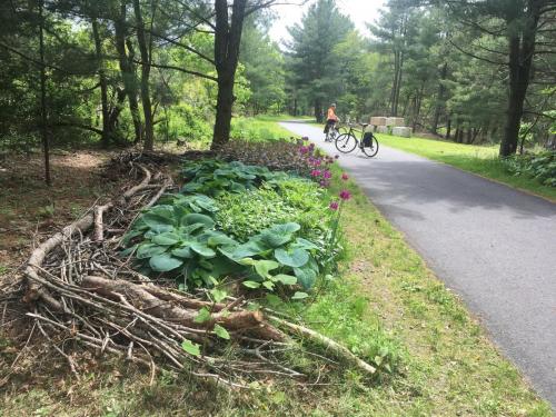
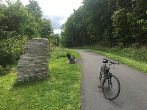
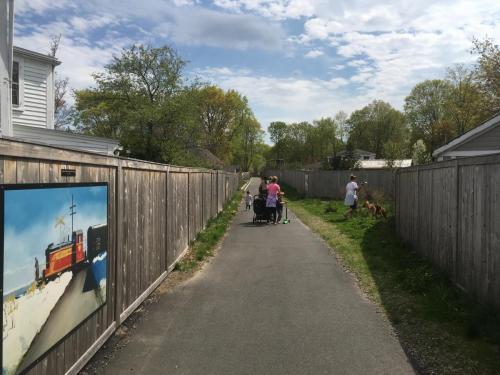
Phase I: The first phase of the Clipper City Rail Trail was completed in 2010, and is a 1.1 mile multi-use pathway running between the Massachusetts Bay Transportation Authority (MBTA) commuter rail station and the shoreline of the Merrimack River near downtown Newburyport. The trail corridor ranges from about 40 to 80 feet wide, and the multi-use asphalt pathway is 10 feet wide for walkers, bicyclists, and other non-motorized users. In a relatively short distance, the trail corridor cuts through hills and climbs above the harbor, passing through a variety of environments including an industrial park, a densely developed neighborhood, and the waterfront. An 8-foot-wide pile-supported boardwalk made of Forest Stewardship Council (FSC) certified tropical hardwood connects the Rail Trail to Cashman Park along the river. There are a number of stairway and spur trail connections to side streets, as well as amenities such as Haley’s Ice Cream and the Graf Ice Skating Rink, and various bakeries, coffee shops, and restaurants are located a short distance from the trail. Two public schools located nearby, the River Valley Charter School and the Molin School, regularly use the trail for students and teachers to walk to the downtown, the harbor, parks, and other destinations. The Rail Trail has a distinct and attractive character due in large part to the extensive public art the City has installed along the corridor.
Phase II: The City is currently working on completing Phase II of the multi-use pathway, which extends the trail about 1.5 miles. Phase II provides the general public with additional opportunities for transportation, recreation, physical activity, sociability, and connections to parks, the business district, and neighborhoods. Abandoned in the 1970’s, the old City Branch railroad line provided freight service during the previous century to Newburyport’s waterfront, in particular picking up coal that was brought in by ship for distribution to inland points. Much of the corridor had become overgrown and subject to dumping and encroachment. Phase II of the Rail Trail has a diverse and interesting character for residents and visitors, travelling along the Merrimack River waterfront, through the densely settled South End residential neighborhood, and curving through acres of woodlands into the Town of Newbury. Additional funding is needed to support completion of the riverfront portion of the trail between the American Yacht Club and Joppa Park.
Rail Trail Project History
The concept of a Rail Trail has been discussed in the City of Newburyport since the 1970’s when railroad use of the corridor was abandoned. The City made the Rail Trail a particular priority in the Newburyport 2001 Master Plan, 2003 Waterfront Strategic Plan, and 2012 Open Space and Recreation Plan. Tasks associated with the long-term project included conducting title examinations to determine ownership, negotiation of right of way agreements and temporary easements, testing for contamination, applying for numerous grants, hiring and managing a design firm, hosting public meetings, permitting the project, and working with the Massachusetts Department of Transportation’s Highway Division to finalize design and construct the project.
The first phase of the Rail Trail is built upon an old rail corridor owned by the Massachusetts Bay Transportation Authority (MBTA), and the City holds a 99-Year Lease. Newburyport was the first municipality in the state to secure such a 99-year lease from the MBTA in 2005 in order to meet Federal Highway Administration (FHWA) and state standards for investment of federal and state transportation funding. The MBTA rail corridor was used informally by the public as a footpath for many years, and a portion had been adopted by a neighborhood. However, it contained substantial debris from the former railroad as well as typical low level contamination, lacked connectivity to other trails and sidewalks, lacked fencing, subjected users to an at-grade crossing at busy Low Street, and experienced encroachments, dumping, flooding, overgrown vegetation, homeless encampments, and other problems. The City hired Vollmer Associates, which merged with Stantec Consulting Services, to develop the design plans, and the design and permitting were completed in 2007. The state hired S&R Construction Enterprises to construct the Rail Trail between 2008 and 2010. The state also hired Prime Coatings to paint the Route 1 Gillis Bridge and Rail Trail/Harborwalk underpass. In addition, the City hired Vine Associates to design the boardwalk connection to Cashman Park, which was built by North Shore Marine. Rights-of-way, design, permitting, fund-raising, municipal oversight of construction, and selection of public art were coordinated by the Newburyport Planning Office’s Senior Project Manager, Geordie Vining. The Rail Trail is managed by Newburyport’s Parks Director Lise Reid and Parks Manager Mike Hennesey.
The second phase of the Rail Trail is built primarily on the old Newburyport Railroad City Branch corridor. Re-assembling the corridor for the rail trail was a complicated task, as pieces of it had been acquired by National Grid, the U.S. Coast Guard, New England Development, the Newburyport Redevelopment Authority, and some individual landowners after railroad operations were abandoned. The City purchased property from B&M/Guilford Transportation, secured a 99-year lease from National Grid, and secured permanent trail easements from the other landowners. The City hired consultant Stantec to develop plans and secure permits, with approvals from MassDOT, and the state bid the project out and contracted with ET&L to build the Phase II Rail Trail with federal and state transportation funding. Approximately 85% of the trail is complete, and the City is working to complete the trail along the complicated riverfront section between Joppa Park and the American Yacht Club.
Art and Features
Click on the photo below to see art and features along the trail.
Funding
Funding for the design of the first phase of the Clipper City Rail Trail came primarily through grants from the Massachusetts Department of Transportation Highway Division and the Massachusetts Department of Conservation and Recreation (DCR), as well as the Community Preservation Committee and City Council. The City also secured nearly $3 million in federal and state transportation funding for construction of the Rail Trail, primarily the federal Congestion Mitigation and Air Quality (CMAQ) Improvement Program which is designated specifically for projects that help reduce congestion and tailpipe emissions including bicycle and pedestrian pathways. Two grants were secured from the federal-state Recreational Trails Grants Program, and the Massachusetts Seaport Advisory Council was the primary source of funding for the design and construction of the boardwalk connection. With assistance from the City Improvement Society, other funding was generously provided by the Mayor Gayden W. Morrill Charitable Foundation, Enpro Services, Riverside Cycle, Newburyport Development, Newburyport Marinas, the Coastal Trails Coalition, the Newburyport Five Cents Savings Bank, the H. Patterson Hale Jr. Charitable Foundation, the Newburyport Mothers Club, Paula and Jay Jorgenson, and annual fund-raising events by Richard and Dolores Person.
Funds for the design and permitting of the second phase of the Rail Trail have come primarily from the Community Preservation Committee and the City Council, as well as some grants from the Coastal Trails Coalition. Funding for the construction to date of the Phase II Rail Trail has come from $4 million in federal and state transportation funding. Funding for various trail enhancements, including interpretive signs, sculptures and murals, came from the federal-state Recreational Trails Grant Program, the Mayor Gayden W. Morrill Charitable Foundation, and the Coastal Trails Coalition.
Future Trail Extensions
- Massachusetts Department of Transportation: Route 1 and the Route 1 rotary are a major obstacle between the two phases of the Rail Trail and the MBTA commuter rail station. This connection is anticipated to be "Phase III" of the project.
- Newburyport Redevelopment Authority (NRA) and Newburyport Waterfront Trust (NWT): Attractive public access already exists for pedestrians along the central waterfront on the Peter J. Matthews Boardwalk plus the connected Ways to the Water. However, the quasi-public NWT controls the boardwalk and does not allow bicyclists to use it for fear of user conflicts. The City, NRA, and NWT need to work together to determine an appropriate and feasible alignment for a bicycle path to cross the central waterfront, including the existing NRA parking lots and the Waterfront Market Landing Park. Resolution of this particular issue has been stymied by the broader and long unresolved question of how the NRA lots will be redeveloped.
(See map of anticipated full 3-mile rail trail loop.)
Connections to other communities
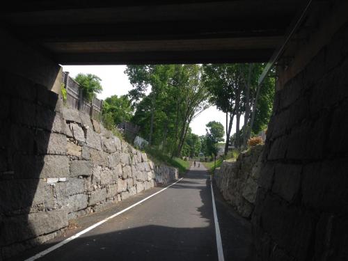
The Town of Salisbury, working with the state, has built the beautiful 1.4 mile Old Eastern Marsh Trail on the same former rail corridor directly across the Merrimack River from the Clipper City Rail Trail. However, the old rail bridge in between is owned by the MBTA and not leased to either municipality. There are significant technical, operational, and financial hurdles to using the old rail bridge to connect the two trails. Instead, the Clipper City Rail Trail allows trail users to loop under the highway and on to the existing Route 1 bridge sidewalk to get to Salisbury. There is a similar safe connection on the Salisbury side. A feasibility study is needed regarding making the Gillis Bridge more safe, functional, and attractive for pedestrians and bicyclists.
In general, the City is actively working with neighboring communities of Newbury, Salisbury, and Amesbury to establish a contiguous regional network of trails; see the nonprofit Coastal Trails Network’s website. Also see information regarding the “Border to Boston” trail concept. The Clipper City Rail Trail is part of the much larger vision of the East Coast Greenway.
Staff Contacts
| Name | Title | Phone |
|---|---|---|
| Geordie Vining | Senior Project Manager | (978) 465-4400 ext 6 |